In the dynamic world of reality capture and data management, efficiency and accuracy are paramount. In this case study, we explore the strategic decision made by Voyansi, a leading full-service reality capture data firm, to integrate Leica Geosystems’ cutting-edge scanning hardware and software into their high-productivity workflows. This partnership exemplified the alignment of goals and technology between two innovative entities.
Fast forward to June 18th, and Voyansi is now officially part of Hexagon, marking a significant milestone in our journey together. This union not only solidifies the synergy we observed during our initial collaborations but also sets the stage for an exciting future of innovation and excellence.
Discover how our shared vision and commitment to excellence have laid the foundation for a powerful partnership, paving the way for groundbreaking advancements in reality capture and beyond.
Speed and Precision
Why a prominent, full-service reality capture data firm chose Leica Geosystems scanning hardware and software for their fast-paced, high-productivity workflows.
“You can capture more, much more information, super-fast. We’re talking about 30 to 60 seconds per setup versus several minutes with other scanners we have tried. We can also take full-color pictures straight from the RTC360. That’s really useful for us.” – Mariano Alberto Gerez, Partners Development Directors at Voyansi.
For Voyansi and their clients, speed is of the essence. For example, one of Voyansi’s clients, a large automobile manufacturing facility in South Carolina with an annual output of 5 million units, sought a rapid digital twin of a 358,706 m² (nearly 4 million ft²) section of the plant. “We had three RTC360s running 10 to 12 hours per day and completed the scans in 5 days,” stated Gerez. This accomplishment underscores the efficiency of Leica Geosystems’ 3D laser scanners and Voyansi’s proficiency in managing such large-scale projects. Their ability to swiftly navigate through massive areas, coupled with strategic planning and execution, distinguishes them in the field.
With another week for processing, Voyansi could present the client with the 3D models to plan expansion, remodelling, maintenance, space management, and asset management. Later, this would also include the production of accurate blueprints of existing facilities and further data extraction and analysis. Gerez adds, “Our methodology and system, honed from years of scanning large buildings, enable us to handle projects of this magnitude. Our trained staff is adept at carrying the heavy load, making us a go-to partner for such extensive projects.”
For yet another automotive industry client, an electric vehicle (EV) manufacturer with multiple facilities in the U.S. and EMEA (Europe, the Middle East, and Africa), Voyansi scanned (terrestrially and with LiDAR equipped UAVs) plants, commercial facilities, warehouses, and offices. They rapidly scanned and produced, for the client, scan-to-BIM (S2B) models at 200, 300, and 400 levels of detail (LOD), as well as 2D drawings. The successful completion of these projects showcases the top-tier technology of Leica Geosystems’ reality capture solutions and Voyansi’s unique expertise in applying this technology to capture extensive and complex environments effectively.
A Growing Business
Voyansi provides full-service scanning, BIM modelling, consulting, and software development for clients large and small. Founded in 2009 by Daniel Biagi and Diego Cotsifis, first as AEC Resource and later as AEC Lab, the firm rapidly became a prominent and respected name in the geospatial services sector. “At the time, the market had a void for an affordable services company that also invested in new technology and ways of working,” said María Mercedes Dalmaso, Business Development Manager at Voyansi. Specialising in large, complex projects sets Voyansi apart in the industry, filling a critical niche for high-volume, intricate projects that require a level of expertise and methodology not commonly found.
“We have been in charge of over 10,000 processes,” commented Dalmaso. “That number includes both laser scanning and BIM services across several continents. In addition to our in-house resources and expertise, we have strong alliances to cover all aspects of digital transformation.” Now, with over 300 employees, 70% of whom are architects, architectural technologists, and engineers, the firm is well established in the U.S. and South America and is expanding in Europe.
“In addition to architects, BIM consultants, engineers, industrial designers, and specialists, there is now a brand-new team of software developers creating tools for workflow optimisation, analysis, data management, and integration,” explained Dalmaso. “We are trying to be all across the digital twin journey in terms of the wealth of services. All the steps from the scanning to the modelling to the creation of reports and extraction of drawings.”
The Essential Solution
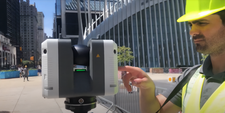
High-definition reality capture is the key to effective and accurate reality data in all downstream forms for BIM, architecture, design, construction, operations, facilities, and asset management. For Voyansi, this meant having the proper hardware and software for precise, timely, and efficient scanning. Their go-to is the Leica RTC360 3D laser scanner, capable of capturing as many as 2 million points per second, in addition to fully registered full-colour images.
Using their RTC360s with in-field application, Leica Cyclone FIELD 360, Voyansi’s workflow benefits from in-field point cloud registration. This ability to preview the data in the field means they can check for completeness and quality, ensuring they get it right the first time. Using the gap-filling feature in Cyclone FIELD 360, the team can quickly capture missing points and fill in gaps. By pairing the RTC360 and Cyclone FIELD 360 with their in-office complement, Leica Cyclone REGISTER 360 PLUS, they can take full advantage of every second spent in the field. Registrations prepared in the field are transferred to the project, where they can be refined and finalised. Thanks to advances both in the office and the field, projects that would have taken two or three times longer in the office to process the data have been reduced to a 1:1 field-to-office process.
The firm also uses other elements of the Leica Cyclone portfolio in the office to clean, analyse, and export data for downstream uses.
A Broad Range of Deliverables
Voyansi is an Autodesk services provider and reseller, and in addition to all major industry-standard BIM and 3D model formats, produces deliverables for customers in, for instance, 3D RVT files, 3D DWG files, 3D NWC, 3D IFC, and more.
Dalmaso provided another example of where the speed and precision of the RTC360 and Cyclone software were vital in enabling their multi-faceted team to rapidly deliver a large and complex project: a client overseeing the planning and logistics for a nuclear power plant slated for decommissioning. “We scanned the entire facility with our RTC360s and a few UAV flights, created a point cloud, then a digital twin,” said Mariano Gerez. “In addition to a Revit model with many attributes attached, including radiation notations, we created a video and virtual reality model to assist in their evaluation of the facility.”
While Voyansi has found the best reality capture solution for their needs, Gerez noted that sometimes the challenge is in educating the clients about the capabilities of such technologies: “Often, they are not aware of the depth of these capabilities. However, they are greatly impressed when we create the models and show them what they can do with it. And especially how quickly we can deliver. After all, in many places, things like BIM are becoming mandatory.”
Firms like Voyansi have embraced high-definition reality capture to stay competitive and ahead of the wave and guide their clients in the same direction. Their unique methodology, extensive experience, and specialised skill in handling large-scale, intricate projects underscore their invaluable contribution to the field, alongside the technological excellence of Leica Geosystems’ laser scanning solutions.